
CloseOut's GIS Works Navigator is the game-changing solution for global broadband deployments.
We're proud to present the ultimate fieldwork quality control feature that streamlines operations, sets new design integration standards, and promises limitless potential. Say hello to efficiency and excellence! Check out the CloseOut GIS Works Navigator feature in your CloseOut app today and embrace the future of a better fieldwork experience.
The CloseOut Team has been working tirelessly to address the challenges faced by our colleagues in the Fiber industry and provide them with the tools they need.
We identified a few key challenges:
- Bridging the Gap: Recognizing the gap between design and actual work and finding effective ways to identify and document the differences between planned routes and what's happening on the ground.
- Seamless Design Integration: Ensuring that our platform enables you to work with existing design maps seamlessly during the actual work.
- Enhanced User Experience: Our commitment to providing an intuitive user interface and a horizontal view of the work, that allows better visualization and execution.
Closeout's GIS Works Navigator has the combined capabilities to face those challenges. It results from our dedication to empowering the Fiber industry with the right solutions. If you are in the fiber business, get ready to overcome these challenges and streamline your operations with CloseOut. Kudos to the product and development team!
GIS Works Navigator + Attribute Visibility
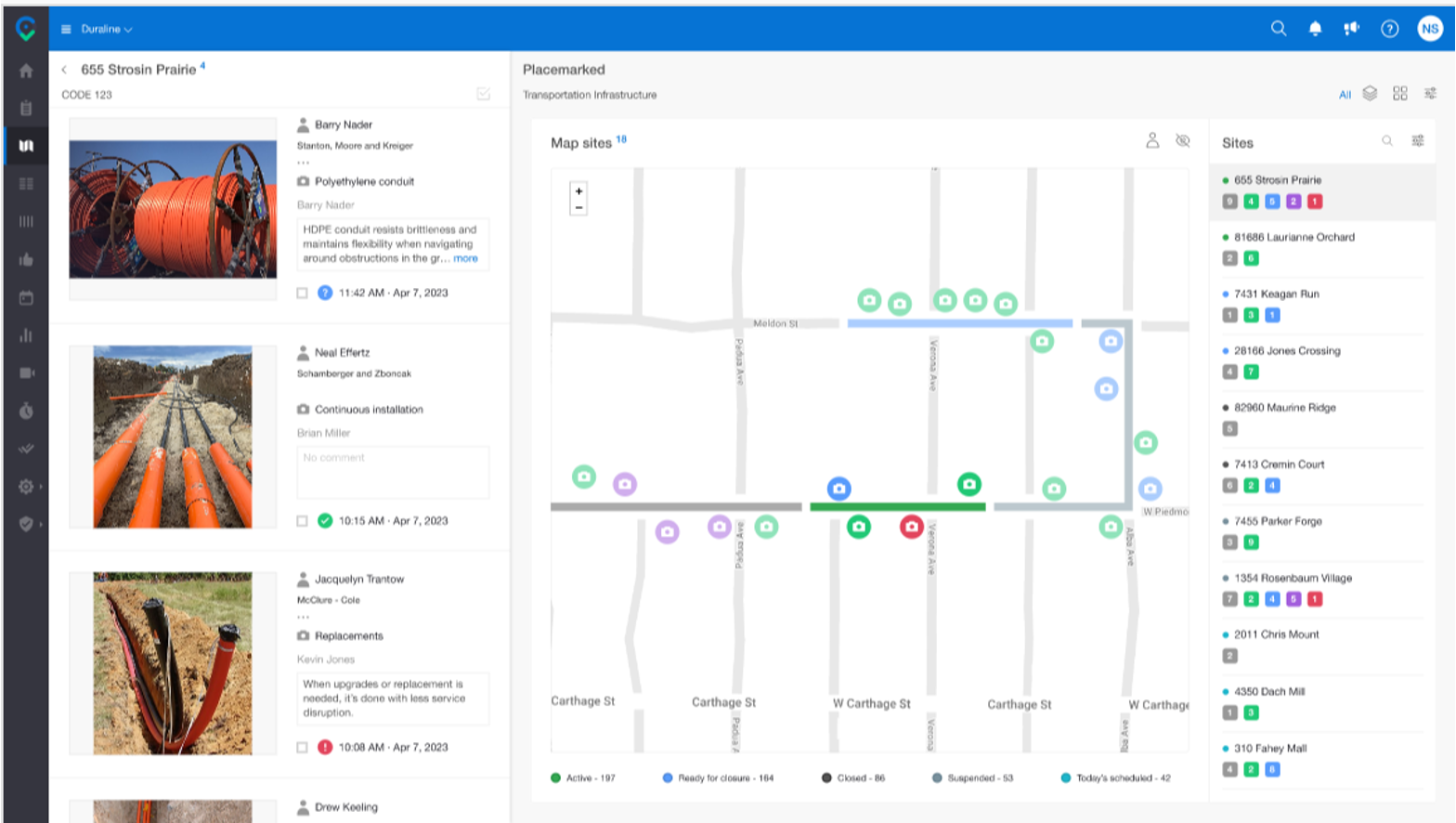
- CloseOut’s GIS Works Navigator is a game‑changing solution for broadband deployments—now enhanced with full attribute visibility from KMZ, KML, DWG, DXF, and SHP files.
- From import to execution, all design data and attributes are instantly available across web, mobile, and tablet. In the field, technicians can see their live location directly on the imported design map, tap any segment to instantly access its attributes, and confidently document the correct structures and elements thus eliminating guesswork and simplifying execution. This bridges the gap between planning and reality, enabling seamless design integration, clear visibility of on-site changes, and fast, intuitive workflows supported by real-time AI quality checks.
- Built to solve key challenges in the fiber industry, GIS Works Navigator brings design, data, and fieldwork into one streamlined experience while improving accuracy, efficiency, and overall quality.
Less guessing. Full visibility. Work done right the first time.